A Blue Trail (also known as water trail) is a dedicated stretch of river that enjoys special clean water safeguards and is a destination for fishing, boating and other recreation. Just as hiking trails are designed to help people explore the land, blue trails help people discover rivers. Blue trails provide a fun, exciting way to get kids outdoors, connect communities to treasured landscapes, and are economic drivers benefiting local businesses and quality of life. Blue Trails become a community resource.
Trail opportunities abound in the 4 Rivers region.
- Ware: Hardwick to Gilbertville to Ware to Palmer Completed 2022!
- Maps – WRBT-upper-11-14-22 WRBT-lower-12-4-22
- Quaboag: East Brookfield to Warren
- Final Upper Quaboag Trail Map: Quaboag-BT-map-7-31-18-FINAL
- Chicopee: Red Bridge to Ludlow/Wilbraham/IO, 2020 opening
- FINAL Chicopee River Blue Trail … Chicopee-10-31-19-2-print
- FINAL Indian Orchard BT area map. orchard-kiosk-9-10-19-print
- Lower Quaboag: Rt 67 to Three Rivers, in the works 2026!
- volunteers welcome!!
- Swift: Bondsville to Three Rivers-future
Summer 2025 News: Lower Chicopee River Blue Trail launch site at Red Bridge may be inaccessible due to power station issue. May be possible to launch across the street under power lines. Parking limited. BE CAUTIOUS.
Lower Ware River Blue Trail note: USGS Gage site drop/rapid – stay left!

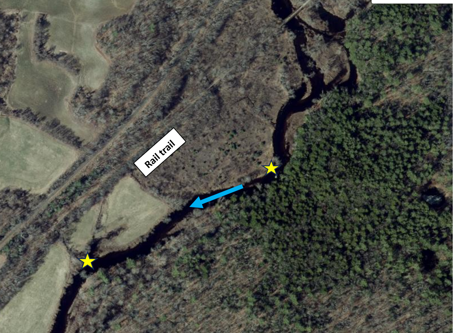
Upper Ware River Blue Trail: Be aware of downed trees in the river, Approach with caution, navigate carefully.
Quaboag Trail Note – see updated notes below…
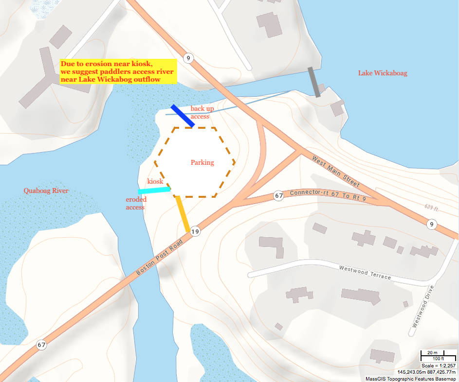
The original access has had some improvements put in place in the spring of 2022 and is passable. Path has rip rap in place. Back up access still a useful option.
Upper Ware Blue Trail
Be aware of downed trees blocking a section below the Pony Truss Bridge.

OTHER RIVER CONDITION ALERTS – LINK (RedBridge)
